

|
|
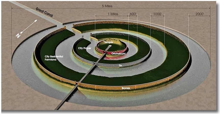
figure 1 This artist's version of the layout of Atlantis/Aullagas is based upon Plato's textual description. art work by Garry T. Spoor |

|
|
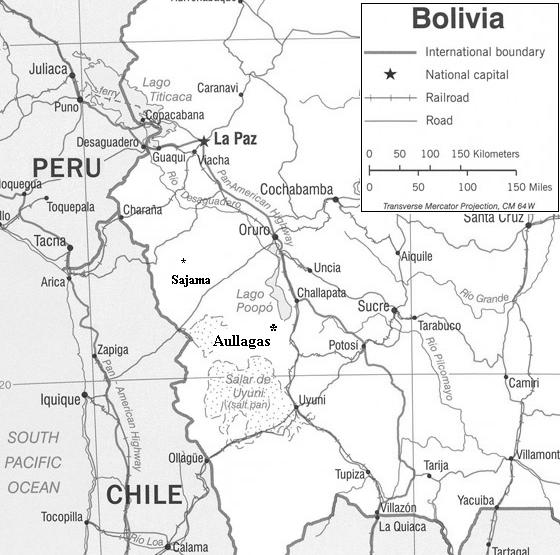
To locate Aullagas on this map, find La Paz, the capital of Peru. Follow the Pan American highway south to Lake Poopo. Aullagas was located on the South West shore of Lake Poopo. |

|
|
The orichalcum ring which figures prominently in the story. |

|
|
Atlantis/Aullagas as it appears today. The point of view of this photo is toward the north east. The northern promontory, or shield wall as Plato called it, can be clearly seen. photo courtesy of Jim Allen |

|
|
Atlantis/Aullagas only seconds away from destruction This is a sectional representation of the Central Island featuring the Temple of the Oracle and the Obelisk of the Kings. Compare the shield wall behind the temple and obelisk with the northern promontory in figure 4. Depicted here is a monstrous inland Tsunami about to breach the shield wall and destroy the city. adapted from art work by Garry T. Spoor |

|
|
Machu Picchu and the Urubamba River Valley. Discovered in 1911 by Hiram Bingham, this is the Incan settlement mentioned in my novel. Note the Urubamba River valley in the colored inset on the lower left. photograph by RJ Paracka |

|
|
Room of three windows at Machu Picchu mentioned in the novel. Note the three windows in the colored inset on the right. photograph by RJ Paracka |
[Buy - Atlantis City In The Sky] |
[Special Features] |
[Home] |